We’re Making Progress on Pilot Hill
For the first time in our history, Pilot Hill trails now connect Laramie to the Medicine Bow National Forest.
With the completion of seven new trail miles in 2021, hikers, runners, and riders can now follow two routes from Laramie to the top of Pilot Hill and back down or enjoy several shorter loops in both the lower and upper sections of the Recreation Area.
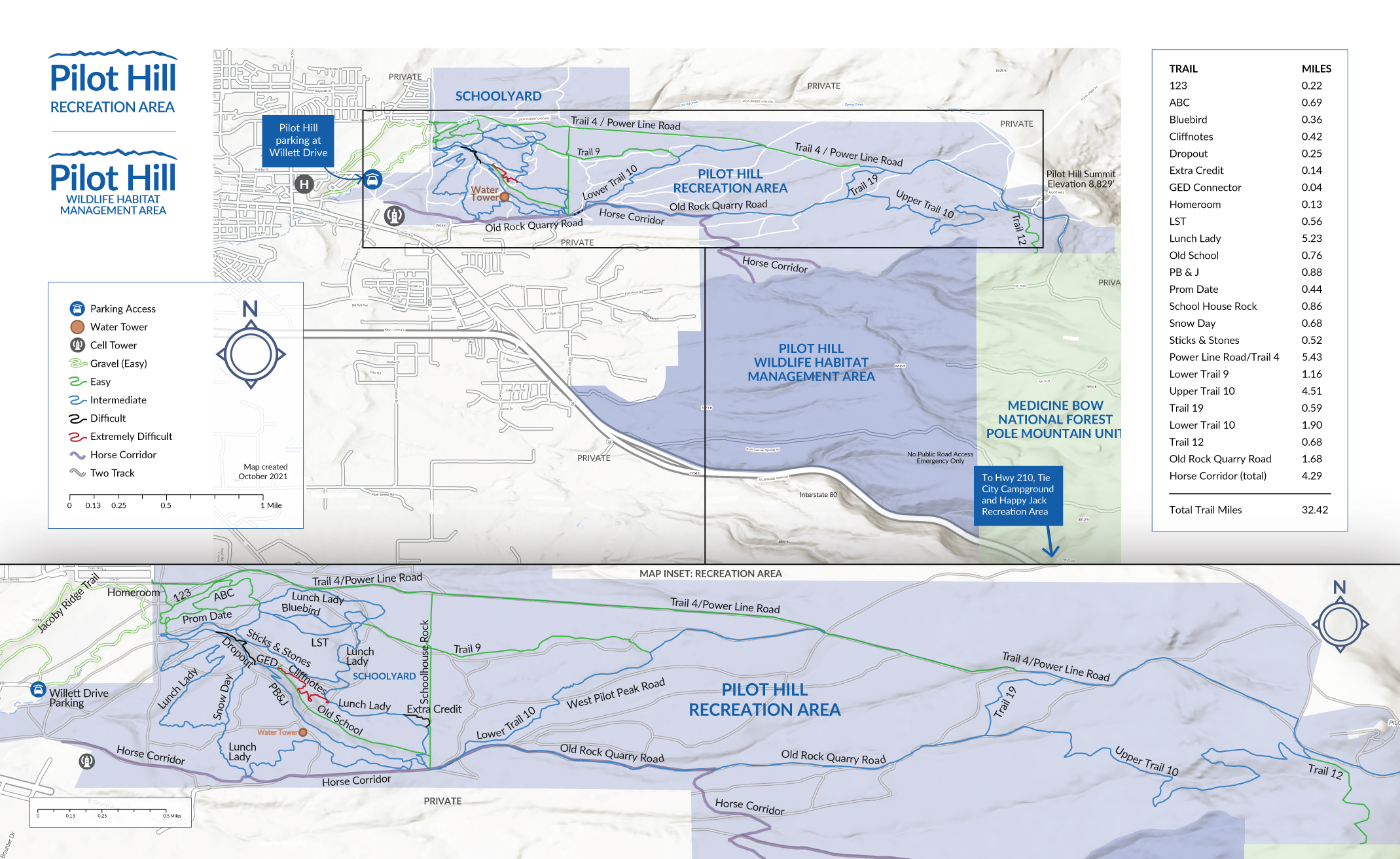 Access from Laramie: The best parking is at the east end of Willet Drive. From there you can easily follow the trail signs to connect with the trails in the Schoolyard section and beyond. Alternatively, there is limited parking along 45th and Crow Streets (please respect surrounding homes by not blocking driveways or residential parking) and on N. Boulder Dr. (respect school bus and private business parking). Limited parking is also available on N. Wister Dr.
Access from Pole Mountain Unit of the Medicine Bow National Forest: Follow FS 703 Rd. to the north, ending at the FS 703G Rd. for parking. From this location, the Pilot Hill boundary is less than ¼ mile. Hiking and horse travel access is also available off the FS 703C, FS 703G and FS 703G roads between May 1 and Jan 31 (weather permitting).
Bottom to Top Routes are approximately 12 miles total round-trip. Plan accordingly and assume the weather will change. Carry water, snacks, jackets, and a fully charged cell phone. Recreate with a partner if possible and inform friends of your recreation plans. Call 911 if help is needed.
Respect trail etiquette. Trails are mostly multi-use for hiking/running, biking, and horse riding.
No camping, campfires or collecting firewood.
Pack in – Pack out all trash including dog waste.
No discharging firearms or recreational shooting.
Respect private property boundaries and seasonal closure of the WHMA.